
|
|
|
|
|
|
|
|
|
|
|
|
| Township: |
|
Range: |
|
Section: |
|
|||||
| CAMA: |
|
Section: |
|
|
||||||
| Lat | | Deg: |
|
Min: |
|
Sec: |
|
||
| Lng | | Deg: |
|
Min: |
|
Sec: |
|
|
|
| Decimal | |
Lat: |
Lng: |
|
| Road Name: |
|
|
| Intersection: |
|
|
|
|
|
Last Name First - Avoid Punctuation Search Example: 'smith john' or 'smith j'. |
|
| Book: Page: |
| Doc Type: | |
| Name: From: To: |
| Click for More Search Options |
|
|
|

|
|||||
|
|||||
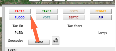
| Geocode: | |||||
| Legal: | |
| Owner(s): | |
| Mail: | |
| Prop: | |
| Physical Address(es):(Click address to zoom) | Deeds |
|
|
|
|
||||
|

Missoula County’s Property Information System provides a variety of features for citizens and businesses conducting searches related to property ownership. The property information system can be searched by applying any of the following criteria:
There are a variety of GIS Layers and Basemaps to choose from in the Layers Tab on the left.


 Smart911 is a free service that Missoula County provides to residents; it has proven to be lifesaving all across the country.
With Smart911, citizens can create a secure Safety Profile that includes any details they may want 9-1-1 to have during an emergency;
such as medical history, emergency contacts, household information or the number of children and pets in the home, etc. It is completely
voluntary and citizens interested in signing up can provide as much or as little information as they like. To better understand how
Smart911 can be used to aid the response to a 9-1-1 call, check out this video of how a Dispatcher Saved a Stranded Driver with the Help of Smart911.
While Missoula County has made all attempts to ensure the correctness and suitability of information under our control and to correct any problems or errors which have been brought to our attention, no representation or guarantee can be made as to the correctness or suitability of that information or any other linked information presented, referenced, or implied. No endorsement is intended or made of any hypertext link, product, service, or information either by its inclusion or exclusion from this system.
The GIS data on this system DOES NOT constitute legal record or legal survey and is for reference only. Anyone using this information should first consult original records and personally verify the accuracy of any and all information/data provided on this system. If you have questions regarding your legal property boundary contact a qualified licensed land surveyor.
For information security purposes, the computer systems that host Missoula County and other County websites employ software programs to monitor network traffic to identify unauthorized attempts to compromise its devices. These attempts to cause damage could be subject to legal action. This would include attempts by anyone to ‘mine’ or grab data from any of our web servers for personal use.
This mapping system is specifically designed to work with Google Chrome web browser.
This site is subject to changes/modifications without prior notification.Some data contained within this theme may have originated from external sources separate from Missoula County. Anyone using this information should first consult original records and personally verify the accuracy of any and all information/data provided. Please reference the main disclaimer for this site for more information.