Ownership, taxes, legal descriptions, surveys, recorded documents and more — all on one map.
Use the search panel at the top left to find a property.
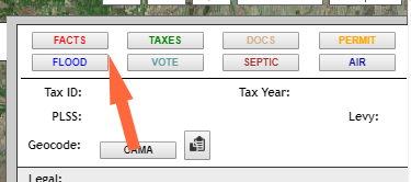
Click any parcel for owner, tax, legal and address details.
Step-by-step guides for searching, reading parcel info, printing and using layers.
Questions or problems? Contact Missoula County GIS.
The default imagery basemap uses Esri's older World Imagery (Clarity) service instead of the 2018 version. It is older (~2010–2012) but clearer and more accurate. Newer imagery is useful for spotting recent changes, but its spatial accuracy should be verified. NAIP 2017 is also available: less sharp than Clarity but more accurate than the newer Esri imagery.
CAMA / ORIONState of Montana DOR Offices / State Library — web link
Zoning
Missoula County CAPS Office — [email protected] ·
web link
City of Missoula Planning —
web link
National Hydrography Dataset — web link
Smart911 is a free service Missoula County provides to residents, and it has proven lifesaving across the country. You can create a secure Safety Profile with any details you want 9-1-1 to have in an emergency, such as medical history, emergency contacts, household information, or the number of children and pets in the home. It's completely voluntary, and you can share as much or as little as you like.
Smart911 is endorsed by all of Missoula's emergency response agencies as an important part of a personal and family emergency preparedness plan.
While Missoula County has made all attempts to ensure the correctness and suitability of information under our control and to correct any problems or errors brought to our attention, no representation or guarantee can be made as to the correctness or suitability of that information or any other linked information presented, referenced, or implied. No endorsement is intended or made of any hypertext link, product, service, or information either by its inclusion or exclusion from this system.
For information security purposes, the computer systems that host Missoula County and other County websites employ software programs to monitor network traffic to identify unauthorized attempts to compromise its devices. These attempts to cause damage could be subject to legal action. This includes attempts by anyone to ‘mine’ or grab data from any of our web servers for personal use.
This mapping system is designed for the Google Chrome web browser. This site is subject to change without prior notice.
Please send any questions or comments through the GIS Contact Us page.

This version is built on Esri's modern ArcGIS Maps SDK for JavaScript, which will be the standard for all Missoula County web apps. It integrates better with shared GIS resources in ArcGIS Portal, Server and ArcGIS Online. Check back often for new features.
|
Add Map Note |
|
Clear Map Notes |
|
|
|
Identify Property Here |
|
Identify Historic Property Here |
|
|